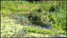
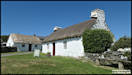
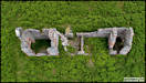
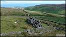
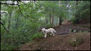
July 4th
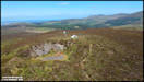
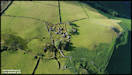
Some pictures taken
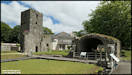
on a visit to Rushen Abby at Ballasalla yesterday morning. The abbey was
established in 1134 and remained as such until the English King Henry VIII
dissolved the monasteries in the 16th Century. From the early 1900s the
abbey grounds were a popular tourist destination, with cream teas being
served and a wooden dance hall being constructed in the grounds.
After WW2 the grounds were open to the public at least into the 1970s or
80s and up to the early 1990s the location was used by by nightclub 'The
Academy'. Subsequently it fell into a bad state of repair until acquired
by Manx National Heritage in 1998 and was restored as a visitor and historical
attraction. Panasonic TZ200 3/7/19
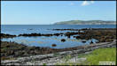
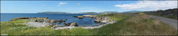
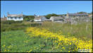
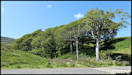
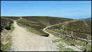
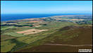
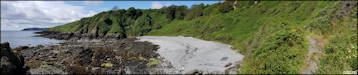
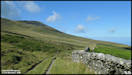
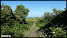
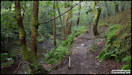
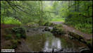
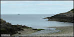
    A detour from the main
road between Castletown and Port Erin along the narrow single track road
at Pooil Vaaish. Panasonic TZ200 3/7/19
A detour from the main
road between Castletown and Port Erin along the narrow single track road
at Pooil Vaaish. Panasonic TZ200 3/7/19
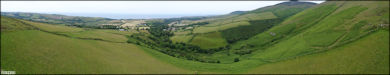
 July 5th
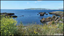
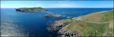
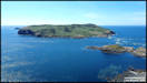
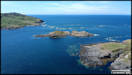
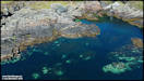
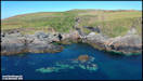
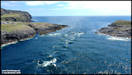
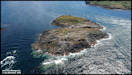
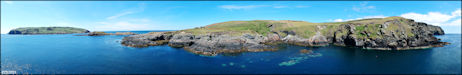
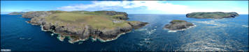
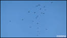
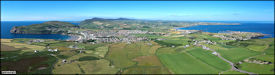
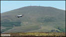
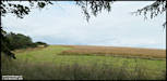
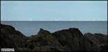
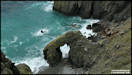
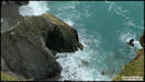
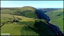
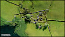
Some Aerial photography
from Wednesday afternoon at the Calf Sound. DJI Spark 3/7/19
July 5th
Some Aerial photography
from Wednesday afternoon at the Calf Sound. DJI Spark 3/7/19
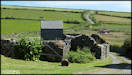
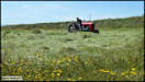
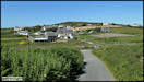
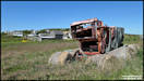
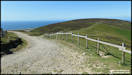
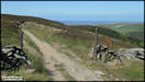
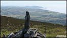
  July 6th
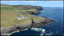
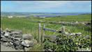
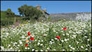
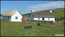
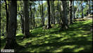
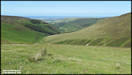
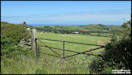
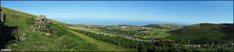
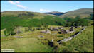
Catching up on pictures
taken last week! These were at Cregneash on Wednesday afternoon.
Panasonic TZ200 3/7/19
July 6th
Catching up on pictures
taken last week! These were at Cregneash on Wednesday afternoon.
Panasonic TZ200 3/7/19
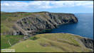
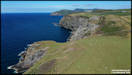
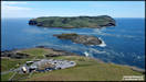
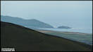
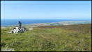
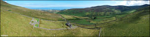
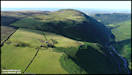
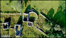
 Aerial photography from
Mull Hill. DJI Spark 3/7/19
Aerial photography from
Mull Hill. DJI Spark 3/7/19
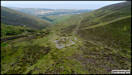
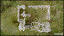
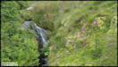
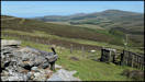
  July 8th
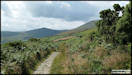
Pictures taken on a
walk in the hills to the east of Kirkmichael, taking the Phantom 4 drone
in a rucksack to investigate three former industrial sites long abandoned.
My thanks to Peter Killey of Manx Scenes
Photography for information on the Glion Kiark quarry site and to Don
Smith, Peter Geddes and the Laxey Mines
Research Group for information on the second and third sites.
DJI Phantom 4 Pro 4/7/19
July 8th
Pictures taken on a
walk in the hills to the east of Kirkmichael, taking the Phantom 4 drone
in a rucksack to investigate three former industrial sites long abandoned.
My thanks to Peter Killey of Manx Scenes
Photography for information on the Glion Kiark quarry site and to Don
Smith, Peter Geddes and the Laxey Mines
Research Group for information on the second and third sites.
DJI Phantom 4 Pro 4/7/19
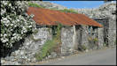
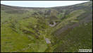
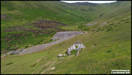
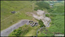
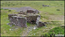
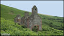
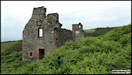
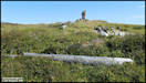
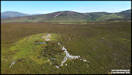
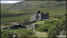
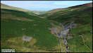
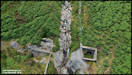
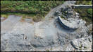
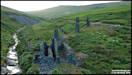
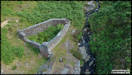
 Glion Kiark
This was a slate quarry
cut into the north slopes of Sartfell. There was a substantial office
building that also contained a blacksmith, stables and accommodation for
the quarrymen, many of whom were Welsh. The remains of the building
still stand, including a bell tower at one end giving it the appearance
of a church. The bell was in fact rung to indicate shift change time
for the quarrymen. The quarry was active until around 1874.
Glion Kiark
This was a slate quarry
cut into the north slopes of Sartfell. There was a substantial office
building that also contained a blacksmith, stables and accommodation for
the quarrymen, many of whom were Welsh. The remains of the building
still stand, including a bell tower at one end giving it the appearance
of a church. The bell was in fact rung to indicate shift change time
for the quarrymen. The quarry was active until around 1874.
 I wasn't sure if I would
make all three sites in the afternoon, but it didn't take too long to reach
the first flying location above the quarry site so I decided to press on
the the others.
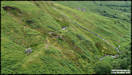
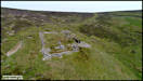
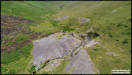
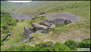
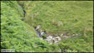
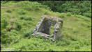
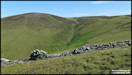
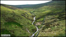
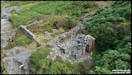
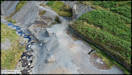
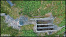
A fairly strenuous hike
around Sartfell brought me to my second site of interest at the top end
of Glion Kiark, between Sartfell and Slieau Freoaghane. It is another ruin
that I had seen from a distance before and always assumed it was the remains
of a sheepfold. In fact it has an industrial history, an unsuccessful
attempt to find a north/south vein. Little now remains of the buildings,
but there does seem to be a water wheel case there. I'm not sure
quite where they would have obtained the water from as it's close to the
ridgeline and there seems doubt that a wheel was actually installed.
I wasn't sure if I would
make all three sites in the afternoon, but it didn't take too long to reach
the first flying location above the quarry site so I decided to press on
the the others.
A fairly strenuous hike
around Sartfell brought me to my second site of interest at the top end
of Glion Kiark, between Sartfell and Slieau Freoaghane. It is another ruin
that I had seen from a distance before and always assumed it was the remains
of a sheepfold. In fact it has an industrial history, an unsuccessful
attempt to find a north/south vein. Little now remains of the buildings,
but there does seem to be a water wheel case there. I'm not sure
quite where they would have obtained the water from as it's close to the
ridgeline and there seems doubt that a wheel was actually installed.
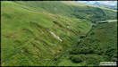
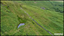
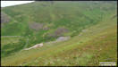
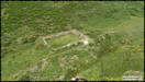
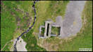
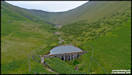
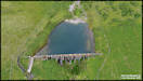
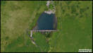
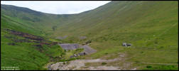
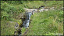
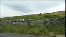
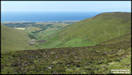
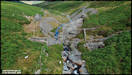
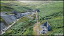
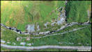
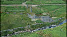
     Walking down the course
of the old road initially and then skirting around Slieau Freoaghane brought
me into the next valley where my final flying site was the Kirkmicheal
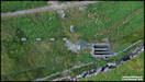
Lead Mine, which was active from 1868 to 1883. Downstream a bit from
the mine is an now disused reservoir with a concrete dam.
Walking down the course
of the old road initially and then skirting around Slieau Freoaghane brought
me into the next valley where my final flying site was the Kirkmicheal
Lead Mine, which was active from 1868 to 1883. Downstream a bit from
the mine is an now disused reservoir with a concrete dam.
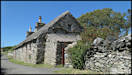
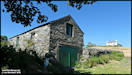
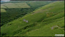
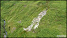
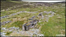
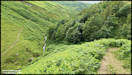
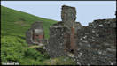
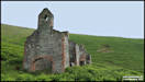
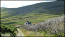
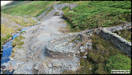
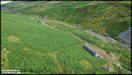
 On the walk back to
the car, following the sheep tracks as they know the best places to cross
the streams! Some ground level photography
passing the buildings
of the Glion Kiark Quarry. Panasonic TZ200
On the walk back to
the car, following the sheep tracks as they know the best places to cross
the streams! Some ground level photography
passing the buildings
of the Glion Kiark Quarry. Panasonic TZ200
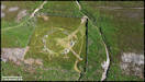
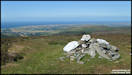
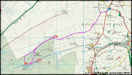
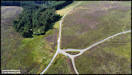
     July 10th
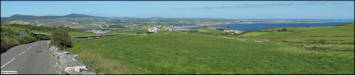
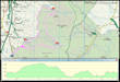
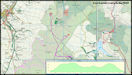
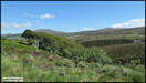
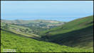
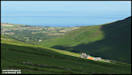
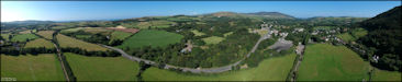
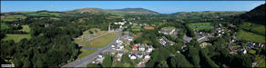
Another walk in the
hills to the east of Kirkmicheal on Saturday afternoon. It's a mix
of ground level and aerial pictures. The map shows the proximity
of this walk and the one undertaken two days previously. Panasonic
TZ200 & DJI Spark 6/7/19
July 10th
Another walk in the
hills to the east of Kirkmicheal on Saturday afternoon. It's a mix
of ground level and aerial pictures. The map shows the proximity
of this walk and the one undertaken two days previously. Panasonic
TZ200 & DJI Spark 6/7/19
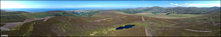
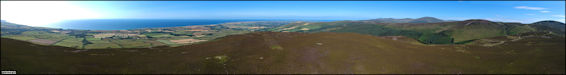
   Finishing with a couple
of aerial panoramas at Slieau Dhoo and Slieau Curn.
Finishing with a couple
of aerial panoramas at Slieau Dhoo and Slieau Curn.
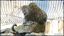
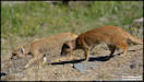
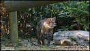
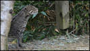
 July 11th
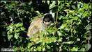
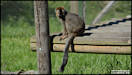
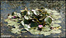
A visit to the Curraghs
Wildlife Park on Sunday afternoon. Nikon D7100 7/7/19
July 11th
A visit to the Curraghs
Wildlife Park on Sunday afternoon. Nikon D7100 7/7/19
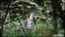
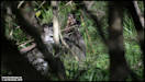
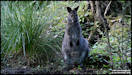
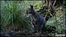
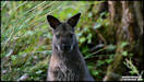
    Some of the wild wallabies
were spotted out in the Curragh.
Some of the wild wallabies
were spotted out in the Curragh.
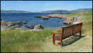
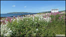
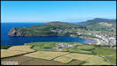
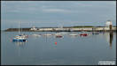
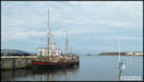
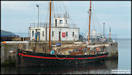
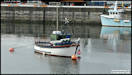
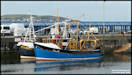
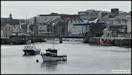
     July 12th
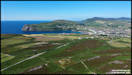
A few pictures taken
in the Douglas Harbour area on Tuesday afternoon after dropping a freind
off to catch a boat.
Panasonic TZ200
9/7/19
July 12th
A few pictures taken
in the Douglas Harbour area on Tuesday afternoon after dropping a freind
off to catch a boat.
Panasonic TZ200
9/7/19
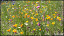
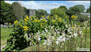
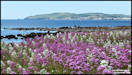
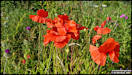
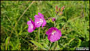
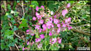
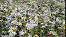
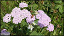
   July 14th
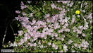
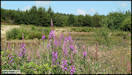
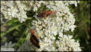
Some wildflower pictures
taken in Onchan Centenary Park (at the top of our road) on my phone while
walking there with our house guest.
Samsung Galaxy S8
11/7/19
July 14th
Some wildflower pictures
taken in Onchan Centenary Park (at the top of our road) on my phone while
walking there with our house guest.
Samsung Galaxy S8
11/7/19
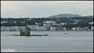
     A phone produced panorama
at Onchan Harbour. Samsung Galaxy S8 12/7/19
A phone produced panorama
at Onchan Harbour. Samsung Galaxy S8 12/7/19
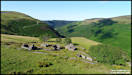
 July 15th
A walk in the upper
Cornaa Valley on Sunday to visit the tholtan of Park Lewellyn and the onwards
to the old North Laxey and Glen Cherry mines
before returning.
I had the Spark drone with me to carry out some aerial photography so the
pictures are a mixture of ground and aerial. The walk was just under
six miles long and took me about 3.25 hours, but that of course included
the aerial flying time.
Panasonic TZ200 &
DJI Spark 14/7/19
July 15th
A walk in the upper
Cornaa Valley on Sunday to visit the tholtan of Park Lewellyn and the onwards
to the old North Laxey and Glen Cherry mines
before returning.
I had the Spark drone with me to carry out some aerial photography so the
pictures are a mixture of ground and aerial. The walk was just under
six miles long and took me about 3.25 hours, but that of course included
the aerial flying time.
Panasonic TZ200 &
DJI Spark 14/7/19
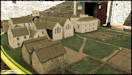
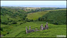
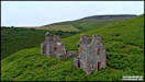
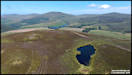
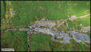
     Park Lewellyn Aerial
Pictures
Park Lewellyn Aerial
Pictures
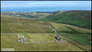 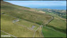  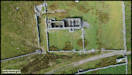 
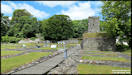
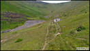
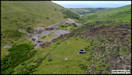
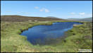
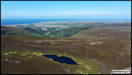
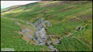
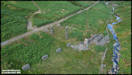
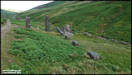
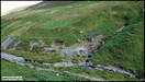
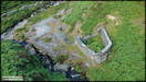
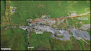
 The North Laxey Mine.
Operated between 1856 and 1897
The North Laxey Mine.
Operated between 1856 and 1897
   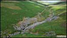 
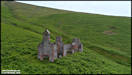
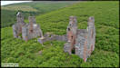
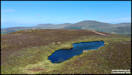
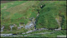
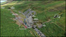
     The Glen Cherry Mine.
     Some more ground level
pictures on the walk back to the car.
Some more ground level
pictures on the walk back to the car.
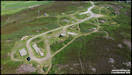
 July 19th
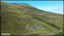
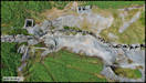
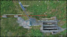
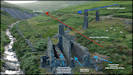
Some more aerial shots
from the North Laxey Mines but with annotations. These are based
on information gleaned from Andrew Scarffe's excellent 'Great Laxey Mine'
book, the Laxey Mines Research Group website and a couple of other sources,
but are purely my take on how things were arranged and connected on the
surface, so are in no way to taken as accurate! (But I hope they are reasonable).
DJI Spark 14/7/19
July 19th
Some more aerial shots
from the North Laxey Mines but with annotations. These are based
on information gleaned from Andrew Scarffe's excellent 'Great Laxey Mine'
book, the Laxey Mines Research Group website and a couple of other sources,
but are purely my take on how things were arranged and connected on the
surface, so are in no way to taken as accurate! (But I hope they are reasonable).
DJI Spark 14/7/19
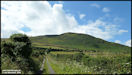
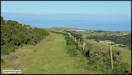
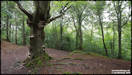
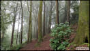
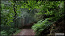
     20th July
A few pictures taken
on a walk in Conrhennie Plantation. Panasonic TZ200 15/7/19
20th July
A few pictures taken
on a walk in Conrhennie Plantation. Panasonic TZ200 15/7/19
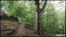
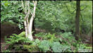
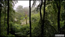
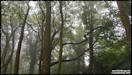
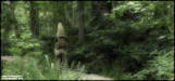
     A walk in a damp and
misty Molly Quirk's Glen with our houseguest yesterday afternoon.
Samsung Galaxy S8 19/7/19
A walk in a damp and
misty Molly Quirk's Glen with our houseguest yesterday afternoon.
Samsung Galaxy S8 19/7/19
     21st July
Four pictures taken
at Groudle yesterday afternoon. Panasonic TZ200 20/7/19
21st July
Four pictures taken
at Groudle yesterday afternoon. Panasonic TZ200 20/7/19
    22nd July
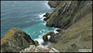
The Marine Drive natural
arch on a rather dull afternoon yesterday. Panasonic TZ200
21/7/19
22nd July
The Marine Drive natural
arch on a rather dull afternoon yesterday. Panasonic TZ200
21/7/19
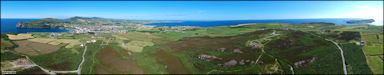
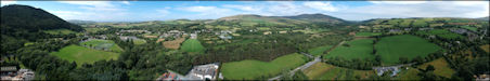
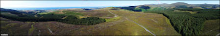
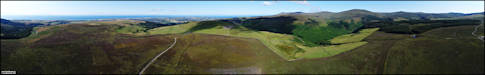
   24th July
Three aerial Panoramas
take yesterday and today in the St John's area. DJI Spark
23 & 24/7/19
24th July
Three aerial Panoramas
take yesterday and today in the St John's area. DJI Spark
23 & 24/7/19
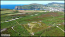
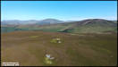
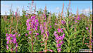
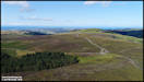
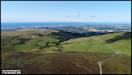
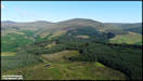
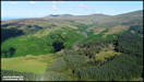
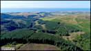
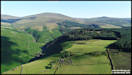
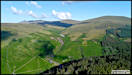
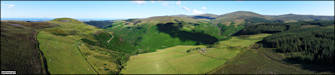
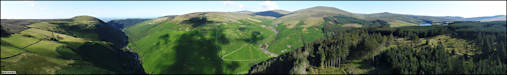
 31st July
Some more aerial pictures
of upland areas on the island. This time it's in the hills above
Ballaugh and Sulby Glen, an area that was extensively farmed at one time
with numerous 'Tholtans' or ruined farms dotting the hillsides. These
days it's mainly hill sheep farming with areas of commercial forestry and
bracken and gorse taking over the land. I've taken a particular look
at the tholtan of Killabrega above Sulby Glen, probably named after a Keeil
dedicated to Breaga, but there seems to be no trace of it now. Inhabited
until the 1940s.
DJI Phantom 4 Pro
29/7/19
31st July
Some more aerial pictures
of upland areas on the island. This time it's in the hills above
Ballaugh and Sulby Glen, an area that was extensively farmed at one time
with numerous 'Tholtans' or ruined farms dotting the hillsides. These
days it's mainly hill sheep farming with areas of commercial forestry and
bracken and gorse taking over the land. I've taken a particular look
at the tholtan of Killabrega above Sulby Glen, probably named after a Keeil
dedicated to Breaga, but there seems to be no trace of it now. Inhabited
until the 1940s.
DJI Phantom 4 Pro
29/7/19
     Finishing with some
scrollable panoramas taken from both locations.
Finishing with some
scrollable panoramas taken from both locations.
|